
If you took a photo with Location Services on, your iPhone wrote the spot into the picture. That is why you can open an old trip and see a pin where you stood. The question is how to see all of those pins at once, and why a few photos never show up.
The map is already in Photos
The Photos app has a map view. Open Photos, go to Library, tap the more button and choose Show Map (older iOS had a Places album instead). It puts your geotagged photos on a map, and you can zoom from a continent to a street. To map just one trip or day, open that collection and tap More, then Show Map. For one photo, open it and swipe up: if it has a location, a small map appears with the place name and an option to adjust it.
It is the quickest answer, and it works without installing anything. Its weakness is that the map covers your whole library unless you start from a collection, so “just last August” takes some work.
Why some photos are missing
A photo only appears on a map if it carries coordinates. The usual reasons it does not:
- Location Services was off for Camera. Check Settings, Privacy & Security, Location Services, Camera. Photos taken while it was off stay without a place.
- The photo came from somewhere else. Screenshots, saved images and many photos received in a chat have no location. Some apps strip it on purpose when you share.
- It was edited or exported by something that dropped the data. Some editors and exports remove it.
- It was shot on a camera that is not your phone. A camera with no GPS writes none.
You can add a place to a single photo from the Photos app (swipe up, then adjust), which is worth doing for a trip that matters.
Find a trip by place and month
A map is most useful when you combine it with time. A few habits that help:
- Start from the month you remember, then look at where its pins cluster.
- Zoom in on a city until the cluster splits into streets, and open the photos from one afternoon.
- If a place is missing a few photos, check the ones taken just before or after: a phone often gets a location only once it finds a signal.
A quieter way to browse: Photo Feed
Photo Feed is a free app that lays your library out like a personal social feed, with months as story bubbles at the top, likes, captions and a map tab. Nothing is uploaded and there is no account to make: it reads your Photos library on the device.
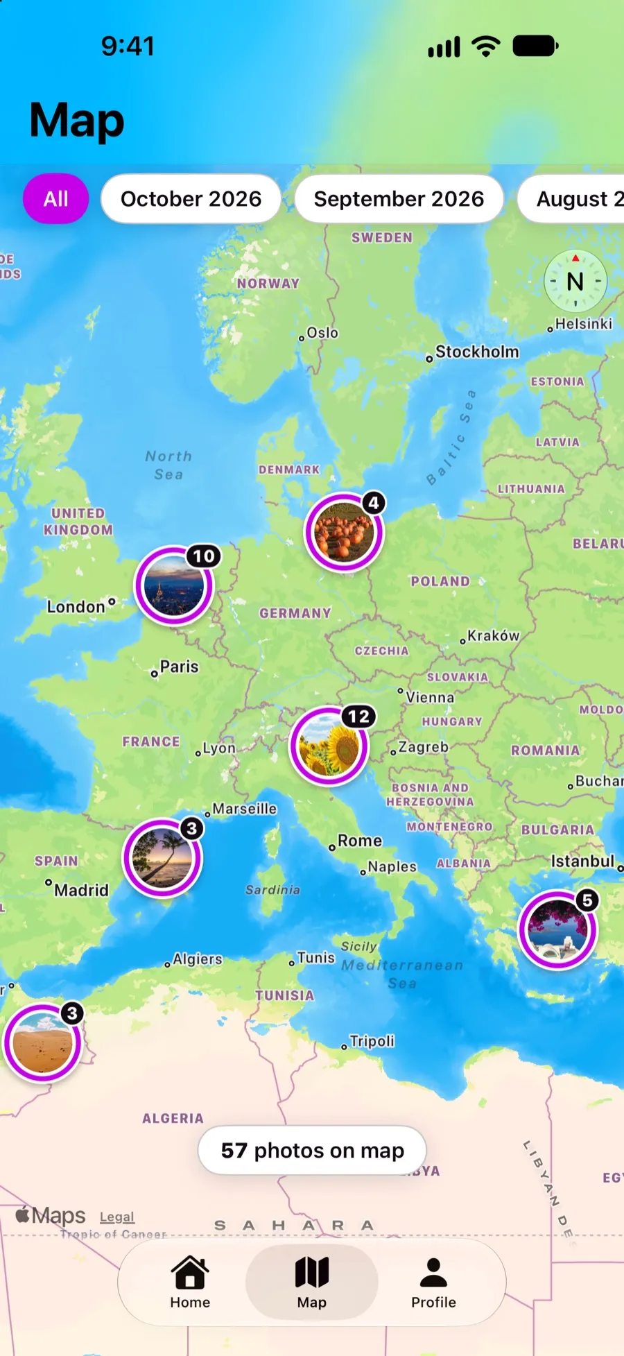
The map shows photos that have a location, grouped into round clusters that split as you zoom. Free maps your newest 60 photos; Pro maps the whole library and adds filters by month or album (the month chips at the top are Pro filters), so “last October” is one tap rather than a memory test. The map itself is drawn by Apple Maps, and Apple may receive the coordinates of a photo to look up a place name; the photos themselves stay on your iPhone.
If a photo has no location it simply does not appear on the map, and nothing is guessed. That is the honest limit of any photo map, this one included.
One more thing worth doing
Before a long trip, check that Camera has Location Services set to While Using. It costs nothing, and in a year you will have a map of the trip you would otherwise have to reconstruct from memory.


